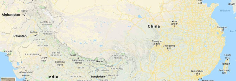
China Removes BRI Map Showing J&K and Arunachal Pradesh As Part Of India
The display of the map on a prominent Chinese government site at a time when the Second Belt and Road Forum is ongoing is at odds with China’s stance. Last month, China destroyed nearly 30,000 world maps printed in the country for not showing Arunachal Pradesh as part of its territory.
28 April 2019
A map hosted on Chinese government’s MOFCOM or Ministry of Commerce’s website displaying routes under China’s flagship Belt and Road Initiative, which showed Arunachal Pradesh and parts of Jammu & Kashmir as part of India — at odds with China’s own stand on these areas, appears to have since been removed.
Though India is boycotting the second Belt and Road Forum taking place in Beijing at the moment, the map also incorrectly showed India to be part of the BRI. The map did not clearly distinguish Pakistan Occupied Kashmir which is a core part of the China-Pakistan Economic Corridor (CPEC). ‘
India has expressed strong opposition against the CPEC, an important connectivity project under the BRI, which links the Gwadar Port in Pakistan’s Balochistan with China’s Xinjiang province, which is the main reason for the country not participating in the BRI.
The display of the map on a prominent Chinese government site at a time when the Second Belt and Road Forum is ongoing is at odds with China’s stance. Last month, China destroyed nearly 30,000 world maps printed in the country for not showing Arunachal Pradesh as part of its territory.
Beijing claims Arunachal Pradesh as part of South Tibet, and the northeastern state is depicted as part of South Tibet Autonomous Region in China’s official maps.
A notice issued by China’s General Administration of Customs on March 22 said that the Qingdao Customs officials found 28,908 maps to be “seriously problematic” when they were examined and they were subsequently destroyed.
Courtesy: IE